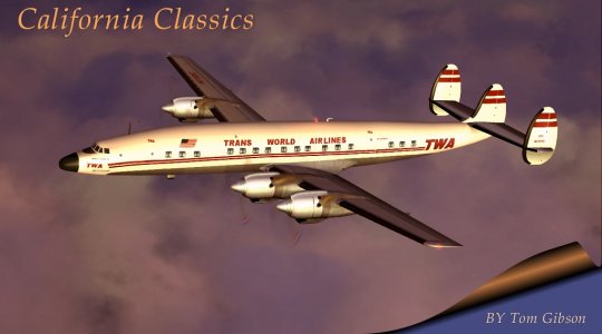
History:
This flight is a classic multi-stop, flying into the little towns in California's
Central Valley. United flew this route from just after WWII until the
propliners were phased out in 1968. United used DC-3's and then
CV-340's on this route, which stopped at Bakersfield, Visalia, Fresno, Merced,
Modesto, Stockton, and Oakland.
Schedule Information
| Date | 1947 | 1950 | 1955 | 1958 | 1966 |
| Equip. | DC-3 | DC-3 | DC-3 | CV-340 | CV-340 |
| Flight Number | 167 | 171 | 179 | 279 | 848 |
| Los Angeles | 8:00a | 7:30a | 6:55a | 7:20a | 7:25a |
| Bakersfield | 8:52a | 8:30a | 8:00a | 8:20a | 8:26a |
| Visalia | -- | 9:10a | 8:40a | 8:55a | 9:03a |
| Fresno | 9:40a | 9:45a | 9:15a | 9:30a | 9:35a |
| Merced | -- | 10:25a | 9:55a | 10:05a | 10:13a |
| Modesto | -- | 10:50a | 10:25a | 10:30a | 10:41a |
| Stockton | 10:32a | 11:15a | 10:50 | 10:55a | 11:08a |
| Oakland | -- | 11:50a | -- | -- | -- |
| San Francisco | 11:20a | 12:10p | 11:25a | 11:29a | 11:40a |
Flight Plan:
Set any wind to blow from the Northwest (around 290 deg); this is typical for the Central Valley. The only turbulence would be over the Tehachapi mountains between Los Angeles and Bakersfield. Typical weather during the summer is clear and hot with a few high clouds, while during the winter it's often a 2-6000 ft overcast sky. Fuel values are for the CV-340.
Los Angeles Intl to Bakersfield Meadows
--------------------- ------ ------ ------- -------- ----- -----
From ID
Freq Course Distance ETE Fuel
To ID
Freq Mag-Crs Total Total Total
--------------------- ------ ------ ------- -------- ----- -----
Los Angeles Intl KLAX 336
29.5 10.4 86.8
top of climb 8500ft
324 29.5 10.4 86.8
--------------------- ------ ------ ------- -------- ----- -----
top of climb 8500ft
336 26.8 6.4 22.5
GORMAN GMN
116.10 323 56.4 16.9 109.4
--------------------- ------ ------ ------- -------- ----- -----
GORMAN GMN
116.10 344 12.0 2.9 10.1
beginning of descent 8500ft 331
68.4 19.7 119.5
--------------------- ------ ------ ------- -------- ----- -----
beginning of descent 8500ft 344
34.4 7.3 6.1
SHAFTER (BAKERSFIELD) EHF 115.40 331 98.8
27.0 125.5
--------------------- ------ ------ ------- -------- ----- -----
SHAFTER (BAKERSFIELD) EHF 115.40 147 3.6
0.9 0.7
Meadows KBFL
134 102.4 27.9 126.3
--------------------- ------ ------ ------- -------- ----- -----
Remember, fly the Magnetic Course (the lower of the two numbers).
1. Los Angeles Intl. ATIS 135.65.
2. 4.5 NM DME from SHAFTER VOR, BFL airport will be almost directly
under you. You may alter course 15 NM before this to pass over the
LOM at a heading of 301 deg for a straight in approach, or you may enter
the pattern and land. Runway 30R (alt. 507 ft., 301 deg), LOM 385,
ILS 111.90, ATIS 118.6, pattern alt. 2500 ft.
Bakersfield Meadows to Visalia Mun
-------------------- ------ ------ ------- -------- ----- -----
From ID
Freq Course Distance ETE Fuel
To ID
Freq Mag-Crs Total Total Total
-------------------- ------ ------ ------- -------- ----- -----
Meadows KBFL
339 15.7 5.5
46.2
top of climb 4500ft 326
15.7 5.5 46.2
-------------------- ------ ------ ------- -------- ----- -----
top of climb 4500ft 339
29.5 7.1 24.8
beginning of descent 4500ft 326
45.2 12.6 71.0
-------------------- ------ ------ ------- -------- ----- -----
beginning of descent 4500ft 339
24.5 3.5 2.9
VISALIA VIS 109.40
326 59.7 16.1 73.9
-------------------- ------ ------ ------- -------- ----- -----
VISALIA VIS 109.40
124 5.2 1.3 1.0
Visalia Mun KVIS
111 64.9 17.4 75.0
-------------------- ------ ------ ------- -------- ----- -----
1. 4.4 NM DME from VISALIA VOR, VIS airport will be almost directly beside you on the right. You may alter course 15 NM before this to pass over the LOM at a heading of 299 deg for a straight in approach, or you may enter the pattern and land. Runway 30 (alt. 292 ft., 299 deg), LOM 220, ILS 108.50, pattern alt. 1800 ft.
Visalia Mun to Fresno Air Terminal
-------------------- ------ ------ ------- -------- ----- -----
From ID
Freq Course Distance ETE Fuel
To ID
Freq Mag-Crs Total Total Total
-------------------- ------ ------ ------- -------- ----- -----
Visalia Mun KVIS
329 16.4 5.8 48.2
top of climb 4500ft 315
16.4 5.8 48.2
-------------------- ------ ------ ------- -------- ----- -----
top of climb 4500ft 329
11.6 2.8 9.8
beginning of descent 4500ft 315
28.0 8.6 58.0
-------------------- ------ ------ ------- -------- ----- -----
beginning of descent 4500ft 329
27.5 2.8 2.3
CLOVIS (FRESNO) CZQ 112.90 315
39.6 11.3 60.3
-------------------- ------ ------ ------- -------- ----- -----
CLOVIS (FRESNO) CZQ 112.90 144
8.0 1.9 1.6
Fresno Air Terminal KFAT 130
47.6 13.3 61.9
-------------------- ------ ------ ------- -------- ----- -----
1. 10 NM DME from CLOVIS VOR, FAT airport will be almost directly under you. You may alter course 15 NM before this to pass over the LOM at a heading of 290 deg for a straight in approach, or you may enter the pattern and land. Runway 29R (alt. 333 ft., 290 deg), LOM 266, ILS 111.30, ATIS 121.35, pattern alt. 1500 ft.
Fresno Air Terminal to Merced Mun/MacReady
-------------------- ------ ------ ------- -------- ----- -----
From ID
Freq Course Distance ETE Fuel
To ID
Freq Mag-Crs Total Total Total
-------------------- ------ ------ ------- -------- ----- -----
Fresno Air Terminal KFAT 309
16.3 5.7 47.9
top of climb 4500ft
295 16.3 5.7 47.9
-------------------- ------ ------ ------- -------- ----- -----
top of climb 4500ft 309
12.4 3.0 10.4
beginning of descent 4500ft 295
28.6 8.7 58.3
-------------------- ------ ------ ------- -------- ----- -----
beginning of descent 4500ft 309
13.6 3.3 2.7
EL NIDO (MERCED) HYP 114.20 295
42.2 12.0 61.0
-------------------- ------ ------ ------- -------- ----- -----
EL NIDO (MERCED) HYP 114.20 305
6.7 1.6 1.3
Merced Mun/MacReady KMCE 292
48.9 13.6 62.3
-------------------- ------ ------ ------- -------- ----- -----
1. Approaching EL NIDO VOR, alter course to land at MCE; enter the pattern and land. Runway 30 (alt. 153 ft., 302 deg), ILS 109.30, pattern alt. 1400 ft.
Merced Mun/MacReady to Modesto City-Co-Sham
-------------------- ------ ------ ------- -------- ----- -----
From ID
Freq Course Distance ETE Fuel
To ID
Freq Mag-Crs Total Total Total
-------------------- ------ ------ ------- -------- ----- -----
Merced Mun/MacReady KMCE 314
10.5 3.7 31.0
top of climb 2500ft 300
10.5 3.7 31.0
-------------------- ------ ------ ------- -------- ----- -----
top of climb 2500ft 314
6.3 1.5 5.3
beginning of descent 2500ft 300
16.8 5.2 36.2
-------------------- ------ ------ ------- -------- ----- -----
beginning of descent 2500ft 314
12.7 3.0 2.5
MODESTO MOD 114.60
300 29.5 8.3 38.8
-------------------- ------ ------ ------- -------- ----- -----
MODESTO MOD 114.60
119 0.2 0.0 0.0
Modesto City-Co-Sham KMOD 105
29.7 8.3 38.8
-------------------- ------ ------ ------- -------- ----- -----
1. MODESTO VOR is at the airport. You may alter course 15 NM before this to pass over the LOM at a heading of 288 deg for a straight in approach, or you may enter the pattern and land. Runway 28R (alt. 97 ft., 288 deg), LOM 367, ILS 111.90, ATIS 127.70, pattern alt. 1300 ft.
Modesto City-Co-Sham to Stockton Mun
-------------------- ------ ------ ------- -------- ----- -----
From ID
Freq Course Distance ETE Fuel
To ID
Freq Mag-Crs Total Total Total
-------------------- ------ ------ ------- -------- ----- -----
Modesto City-Co-Sham KMOD 320
4.4 1.6 13.0
top of climb 1500ft 306
4.4 1.6 13.0
-------------------- ------ ------ ------- -------- ----- -----
top of climb 1500ft 320
11.0 2.6 9.2
beginning of descent 1500ft 306
15.4 4.2 22.2
-------------------- ------ ------ ------- -------- ----- -----
beginning of descent 1500ft 320
0.8 0.2 0.2
MANTECA (STOCKTON) ECA 116.00 306
16.2 4.4 22.4
-------------------- ------ ------ ------- -------- ----- -----
MANTECA (STOCKTON) ECA 116.00 318
4.8 1.2 1.0
Stockton Mun KSCK
304 21.0 5.5 23.4
-------------------- ------ ------ ------- -------- ----- -----
1. Approaching MANTECA VOR, alter course to land at MCE. You may alter course 15 NM before this to pass over the LOM at a heading of 291 deg for a straight in approach, or you may enter the pattern and land. Runway 29R (alt. 30 ft., 291 deg), LOM 271, ILS 109.10, ATIS 118.25, pattern alt. 1200 ft.
Stockton Mun to Oakland Mun
-------------------- ------ ------ ------- -------- ----- -----
From ID
Freq Course Distance ETE Fuel
To ID
Freq Mag-Crs Total Total Total
-------------------- ------ ------ ------- -------- ----- -----
Stockton Mun KSCK
258 14.1 5.0 41.4
top of climb 4500ft 244
14.1 5.0 41.4
-------------------- ------ ------ ------- -------- ----- -----
top of climb 4500ft 258
17.1 4.1 14.3
beginning of descent 4500ft 243
31.1 9.1 55.7
-------------------- ------ ------ ------- -------- ----- -----
beginning of descent 4500ft 257
16.7 4.0 3.3
OAKLAND OAK
116.80 243 47.9 13.1 59.1
-------------------- ------ ------ ------- -------- ----- -----
OAKLAND OAK 116.80
153 0.3 0.1 0.1
Oakland Mun KOAK
139 48.2 13.2 59.1
-------------------- ------ ------ ------- -------- ----- -----
1. The heading in FS2000 seems to be 255 magnetic, not 239.
2. Do not descend too soon or you will hit the mountains! Once
over the mountains, descend, enter the pattern, and land; OAKLAND VOR is
at the airport. Runway 27R (alt. 6 ft., 275 deg.), LOM 341, ILS 109.90,
ATIS 128.50, pattern alt. 1200 ft.
3. If not landing at Oakland but are continuing to San Francisco, fly
the Bridge Visual Approach: Over the OAKLAND VOR, turn left to fly
along the coast, descend to 1900 feet, turn right base at the bridge. Turn
right final at the opposite coastline (over the LOM), cleared to land.
Runway 28R (alt. 11 ft., 282 deg), LOM 379, ILS 111.70, ATIS 135.45.
Oakland Mun to San Francisco Intl.
1. Depart Oakland using runway 28R, turn right to head south along the coast, climb to 1900 ft. Fly the Bridge Visual Approach: Turn right base at the bridge. Turn right final at the opposite coastline (over the LOM), cleared to land. Runway 28R (alt. 11 ft., 282 deg), LOM 379, ILS 111.70, ATIS 135.45.
Welcome to San Francisco!